| Steps in Creating Isogloss Lines |
| Home | Grammar Contents | Previous | Next | Community List | Anishinaabemowin Dialects |
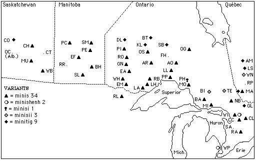
Consider the following data for the word meaning 'island':

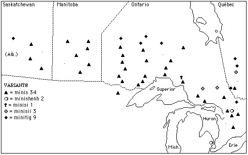
First, we look for regional patterns of distribution in the data. Here, for example, there are five variants, minis, minishenh, minisi, minisii, and minitig. A question arises: are these data distributed geographically in a patterned way, or is the distribution of the five variants random? Hiding the community names will help us to better see patterns:

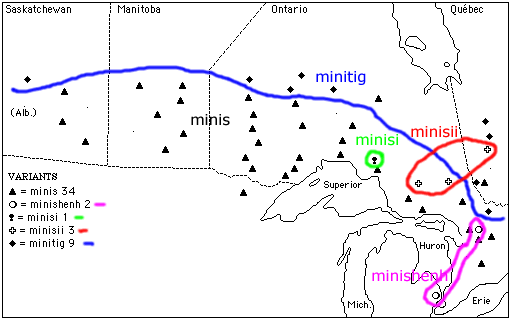
Drawing some isogloss lines produces the following:

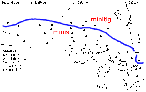
First, we note that by far the most common form is minis, and it tends to occur in the south and the west, but not in the extreme north of Ontario or Quebec. In these northern zones, the prevalent form is minitig. In the southeast, two communities have minishenh. Also, we note that there are three relatively proximate communities with minisii, and one to the west of these with minisi. It is interesting that these communities seem to have a vowel on the end of minis, in one case a short i, and in the other three, a long ii. At this point several hypotheses of relationship are possible. For example, we might try to group our five variants into three sets: 1. minitig; 2. minis-minisi-minisii; and 3. minishenh. The most basic pattern on this map, though, is that between minitig and minis, north and south, with an isogloss roughly as in the following:

Just as a point of detail, note that both of these words begin with the same two syllables, /mini/. The northern form is sometimes found in the southern area as well, but with the meaning, 'island in a river, rocky island.'